
Accurate Land & Terrain Mapping for Better Project Planning
Earth View Dynamics provides topographical surveying solutions that help engineers, architects, planners and construction professionals understand existing site conditions before design and development work begins.
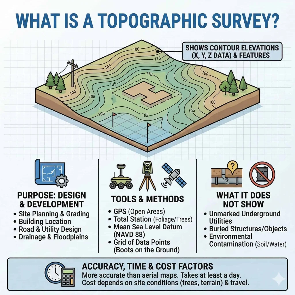
A Topographical Survey provides a detailed representation of the physical characteristics of a site, including land levels, contours, boundaries and existing natural and man-made features.
What Is a Topographical Survey?
A topographical survey, also known as a land or terrain survey, captures the horizontal and vertical characteristics of a site. The collected information can be used to prepare accurate topographic maps, profiles and other survey drawings required for engineering and development projects.
Our approach focuses on establishing reliable horizontal and vertical control, locating contours and accurately recording important site features.
Site Features We Can Map
Depending on project requirements, surveying may include the identification and positioning of:
Roads, Railways, Buildings, Rivers, Streams, Lakes, Trees, Drainage features, Existing structures & Other relevant site features.
Applications
Topographical surveys are commonly used for:
Land development, Residential and commercial construction, Infrastructure development, Road and highway projects, Railway projects, Engineering design, Site planning, Construction planning & Existing-condition documentation.
Our Topographical Survey Covers
Site and land mapping
Ground elevation measurements
Contour surveys
Boundary and feature mapping
Spot level surveys
Existing-condition surveys
Road and corridor mapping
Natural feature mapping
Construction site surveys
Why Topographical Survey Matters
Accurate information about existing terrain allows project teams to make better decisions during planning and design. Reliable elevation, contour and feature data can help reduce uncertainty and provide a strong foundation for subsequent engineering work.
surveying
Get reliable topographical survey information for your next construction, infrastructure or land development project.
Whether you require a Topographical Survey, LiDAR Survey, Aerial Survey, or complete Geospatial Solutions, Earth View Dynamics is committed to delivering accurate data, advanced technology, and dependable support for projects across India.