
Accurate Mapping of Underwater Terrain & Water Bodies
Earth View Dynamics provides bathymetric surveying solutions for projects where accurate underwater information is essential for planning, assessment and development.
A Bathymetric Survey is a type of hydrographic survey used to measure and map underwater terrain. It provides information about water depth and the shape of the land beneath rivers, lakes, reservoirs, estuaries and other water bodies.
What Is Bathymetric Surveying?
Bathymetric surveying determines the depth and underwater characteristics of a water body. Survey data can be used to create underwater terrain maps and understand changes in depth across the surveyed area.
Water Bodies We Can Survey
Depending on project requirements, bathymetric surveying may be applicable to: Rivers, Lakes, Reservoirs, Canals, Estuaries, Water storage bodies and Other suitable water environments.
Applications
Bathymetric surveys can support: River development projects, Reservoir assessment, Canal projects, Water-resource management, Flood assessment, Dredging projects, Hydraulic engineering, Marine infrastructure, Underwater terrain mapping, Infrastructure planning.
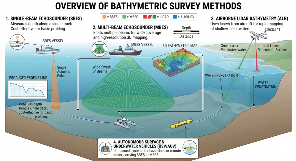
Bathymetric Survey Methods
Single Beam Survey
Multi Beam Survey
Acoustic Doppler Current Profiler
Sub-Bottom Profiling
Why Bathymetric Survey Matters
Accurate information about underwater terrain helps engineers and project teams understand existing conditions before planning construction, dredging, water management or other interventions.
surveying
Get dependable bathymetric information for your river, reservoir, canal, lake or water infrastructure project.
Whether you require a Topographical Survey, LiDAR Survey, Aerial Survey, or complete Geospatial Solutions, Earth View Dynamics is committed to delivering accurate data, advanced technology, and dependable support for projects across India.