
High-Precision 3D Mapping with LiDAR Technology
Earth View Dynamics provides LiDAR surveying solutions for applications where high-density, detailed and efficient 3D data acquisition is required.
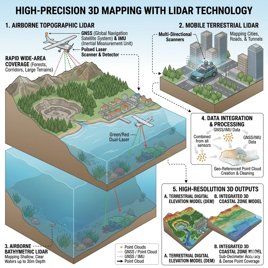
LiDAR — Light Detection and Ranging — is a modern surveying technology that uses pulsed laser light to measure distances and capture detailed spatial information.
What Is LiDAR Survey?
LiDAR systems emit laser pulses toward surrounding surfaces and measure the time taken for the reflected signals to return. The collected measurements can be processed into detailed spatial datasets representing terrain, structures and other physical features.
LiDAR Applications
LiDAR surveying can support: Civil engineering, Land surveying, Highway projects, Road networks, Mining, Quarry operations, Infrastructure mapping, Terrain modelling, Corridor mapping, 3D documentation, Existing-condition surveys.
LiDAR for Infrastructure
LiDAR can help project teams capture detailed information along roads, corridors, structures and other infrastructure environments.
The resulting spatial data can support engineering analysis, mapping, documentation and project planning.
LiDAR for Mining & Quarrying
LiDAR technology can provide detailed information about terrain and site conditions across mining and quarry environments, supporting mapping and monitoring requirements.
Key Benefits
High-Density Data
Detailed 3D Information
Efficient Data Acquisition
Complex Site Capability
Why Use LiDAR?
Compared with many conventional surveying approaches, LiDAR can provide rapid collection of dense spatial information across complex areas.
surveying
Talk to Earth View Dynamics about LiDAR surveying for your infrastructure, engineering, road or mining project.
Whether you require a Topographical Survey, LiDAR Survey, Aerial Survey, or complete Geospatial Solutions, Earth View Dynamics is committed to delivering accurate data, advanced technology, and dependable support for projects across India.